A block of streets in Seraing (near Liege) can't be routed to in both directions because only oneway streets give access to it. #81
Description
1. Description
A block of streets in Seraing (near Liege) can't be routed to in both directions because only oneway streets give access to it.
example point: 50.615011209999999, 5.51039995
2. Impact
When a package needs to be delivered to that spot, we can only report as-the-crow travel info. This might result in issues for routing algorithms (triangle inequalities)
3. Image

4. Reproduction
Perform the following API call on the travel Matrix running v5.0.0. Notice that the culprit is in the arrivals
/matrix/?departures=50.641369576006184,5.574880682085336&arrivals=50.61501121,5.51039995&route_info=geo_json&search_range=10000
5. Notes
It's a bit weird, on OSM the Rue Collard street is not connected to the right on the road:
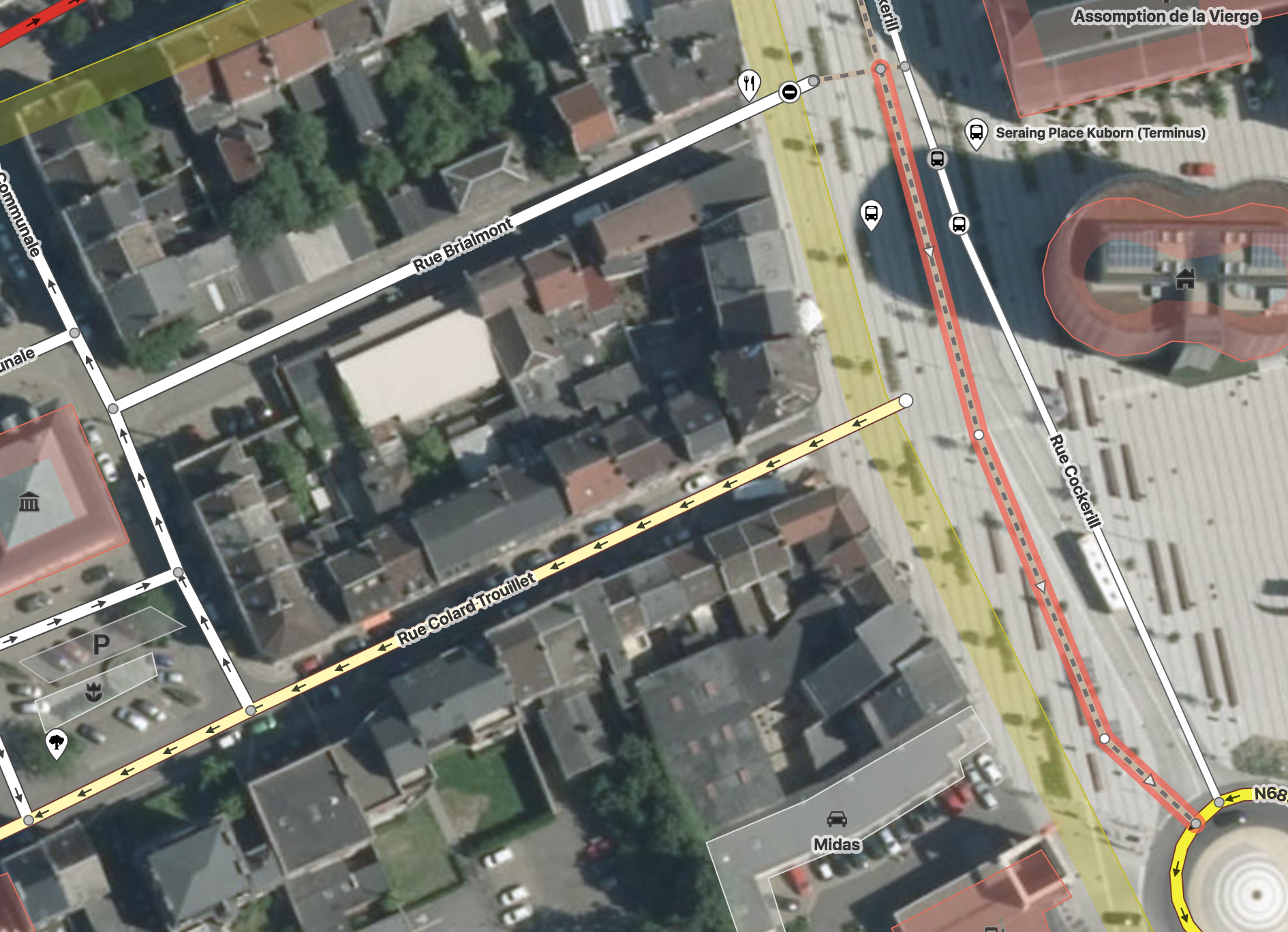
https://www.openstreetmap.org/edit#map=19/50.61468/5.51142
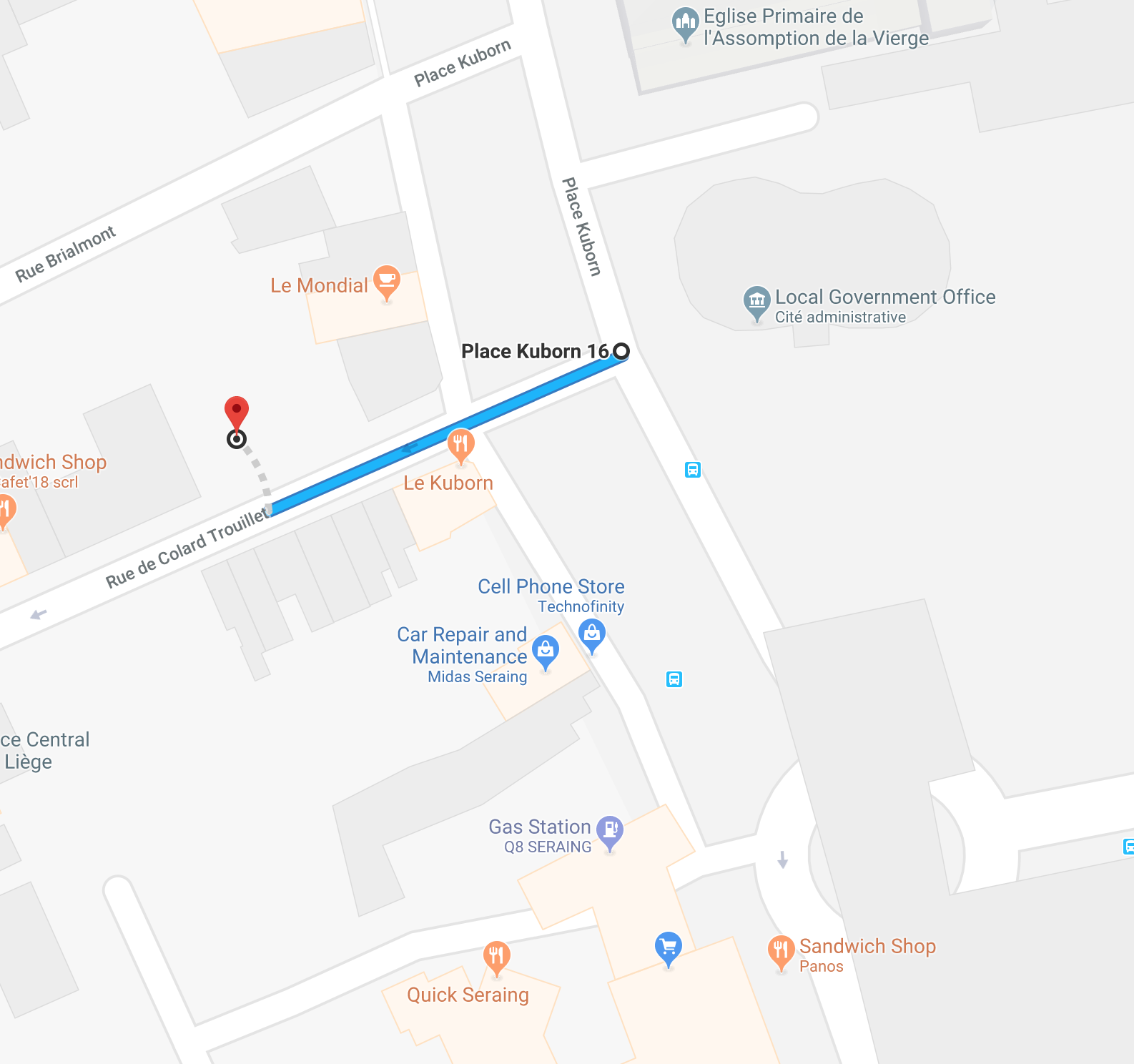
On google Maps there are actually 2 roads on the right connected to it:
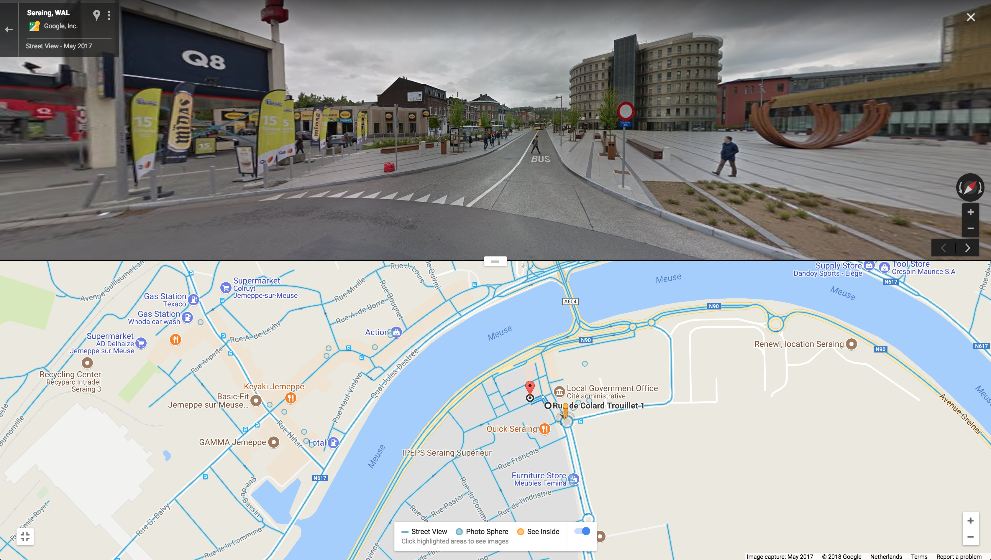
But walking through Street View, it seems to be a Bus Lane:
I don't know what the road-connections should be, it's all quite conflicting.
Perhaps someone knows some OSM editor in Belgium that can check how it should be connected?